Street view for objects, POIs, and addresses
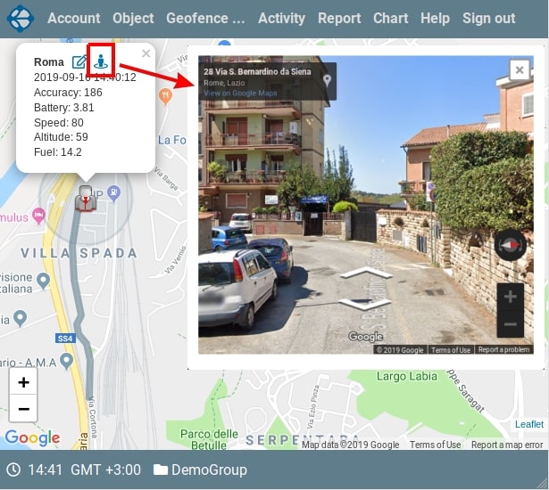
Implemented the ability to display a street view for the current location of the object. To do this, open the object on the map, click on its icon, and a tooltip with the attributes of the object will open. In the upper line of the tooltip, to the right of the context menu icon of the object, there is an icon to display street view. When you click on it in the dialog box, the street view display for the current location of the object will open. To display the street view we use the Google service. The display is done for the location of the object in which it was when you clicked on the icon. To close the dialog box, click on the icon in the upper right corner of the dialog box or anywhere on the screen outside this window. Street mapping is available for many locations, but not for everyone. Sometimes you can get just a black screen, which means that for a given location, the Google service has no data.
In addition to objects, street view is available for POI. To do this, you also need to display POI on the map, click on its icon and in the tooltip, following the name of the POI, an icon will be located to display the street view.
Finally, you can see the street map for addresses and waypoints. When displaying addresses, when you click on an address, a marker with an open tooltip is displayed on the map at the location of this address. Following the name of the address in the tooltip is an icon for displaying street view.
On the Vialam service YouTube channel, a one-minute video presentation is available.