Measurements and calculations on the map
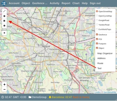
To start working with measurements, open the menu of the control button on the map. This button is located in the upper right corner of the map area. Click on "Tool" button and the map will be displayed in full screen. Controls will appear in the upper left corner of the map area. They allow you to choose the type of measurement area. If the left panel (objects, geofences or tracks) has been opened, it will close. When you exit the measurement mode, its state will be restored. A button “Close” is displayed under the block of controls. Press on it to exit the measurement mode. During the measurements, you can move around the map and change its scale. The elements of choosing the type of measurements from top to bottom allow you to select: a polyline, polygon, rectangle, and round area, respectively. When you select an item, a submenu is displayed to the right of it. Using the submenu, you can cancel the creation of a zone of this type. For a polyline and polygon, it provides elements that allow you to cancel the last point or completes the process of creating a zone.
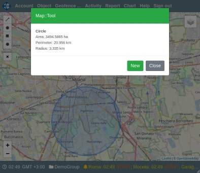
For a rectangular and circular area, the process of completing drawing ends when you release the mouse button. For a polygon, the drawing process ends when you click on the first point (close the line). For a polyline, the process ends when you click on the current point again. After drawing is completed, a dialog box appears on the screen. This window displays the measurement results for the created zone. For a polyline, its length is displayed. For a polygon and a rectangular zone - the area and perimeter. For a circular region - area, circumference (perimeter) and radius.
You can take new measurements by clicking on the “New” button or exit the measurement mode - the “Close” button.
On the Vialam service YouTube channel, a one-minute video presentation is available.